Water and Oil DO mix! "Unitization" anyone?

Oil rig. Photo courtesy of Billy Hawthorn, Creative Commons Licensing, 2008.

Oil rig. Photo courtesy of Billy Hawthorn, Creative Commons Licensing, 2008.

Last week I had the pleasure of attending the 2009 PNW Water Conference organized and sponsored by a variety of state agencies, research institutes, the Environmental Protection Agency, US Department of Agriculture, and the three land-grant universities in the Pacific Northwest (WSU, OSU and Idaho).  It was a marvelous conference–full of good ideas and a nice linkage between land use and water, something that is often neglected by people working in both camps.

At the conference, OSU colleague Todd Jarvis gave a compelling final talk to an almost packed house on “Peak Water Meets Peak Oil: Moving Towards Unitization of Shared Groundwater.”  You can view it here:

The talk brought up a gnarly, uncomfortable truth about groundwater. Namely, ground water managers could learn a lot from how oil companies manage the world’s oil fields.

“Say what!?” you may exclaim. The crowd of generally sympathetic water wonks was also pretty uncomfortable with the comparison. Global oil is purportedly running out, and water is renewed each day by a familiar-to-every-grade-school-kid water cycle. Not so says Jarvis, associate director of the Institute for Water and Watersheds.  While we may very well see a day soon when oil is no longer used as extensively as we do today, since the 1970s, oil extraction has been carefully planned and managed so that wells don’t interfer with each other, and so that oil fields are sustained for the future instead of collapsing when the oil is drained. Furthermore, well fields are managed as market-controlled common-pool resources–where petroleum companies buy into them the same way that shareholders would any type of publicly-traded company (e.g. Microsoft, Ford Motor Company, or Proctor and Gamble). To extract, a company simply buys a right to the field, then has responsibilities for maintaining it in the long run. This is called “unitization” and could quite possibly be the next big thing with managing groundwater.

At present, however, the world’s groundwater is far from unitized.  In the Western United States, for example, our approach is generally to extract it without considering what happens when wells are too closely spaced (they interfere with each other), or if the over-extraction leads to damage (such as collapse of the rock and soil layers when the water is removed from between them). And with few exceptions, U.S. water law engages well owners in a race to the bottom of the proverbial bucket with each other. The bigger pump and the bigger user often wins, while at the same time the millions of exempt (unregulated) wells owned by individual property owners leads to a “death by a thousand cuts” for a whole aquifer and the collective group’s ability to extract more water in the future (see my recent post on that subject). Lastly,  wells have frequently been abandoned and left as open pathways for pollution into the community aquifer, not to mention the myriad other ways for groundwater to be polluted by storage tanks, septic systems or leaching from above.

Abandoned wells are pathways to groundwater pollution. Photo courtesy of Gail Glick-Andrews, OSU.

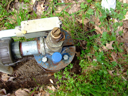
Abandoned wells are pathways to groundwater contamination. Perhaps making them an aquifer shareholder problem would help? Photo courtesy of Gail Glick-Andrews, OSU.

In fact, in most aquifers worldwide, extraction of water is quite similar to nonrenewable oil in that it is extracted much faster than it can be replenished by natural recharge. Pumping of groundwater from aquifers in my native desert Southwest exceeds natural recharge by millions of years since the “fossil” water deposited into some of Arizona’s alluvial basins arrived with the last few ice ages and could not be replaced by the 7-17″ of annual rainfall without a few more million years (of no extraction and normal rainfall patterns)! Even aquifers in Oregon’s Willamette Valley and the groundwater of the  Coast Range valleys may not be replenished at the same rate as the extraction takes place. Wet climates are not at all immune from over-extraction. Professor Robert Glennon from the University of Arizona has written about this phenomenon in his excellent book Water Follies.

In fact, say Jarvis, there are already several cases local and global where groundwater management looks a lot like oil field management. Time will tell, but it just might work to help slow the race to the pump that is vexing groundwater-dependent regions of the world.

So if you’re a groundwater watcher, look for more mention of unitization. Todd has certainly made a splash with his presentation and a short accompanying piece in the “Green Inc.” blog hosted by the New York Times. Perhaps the hard lessons of petroleum geologists and the boom bust cycles of the oil industry will work as well for groundwater managers, large and small.

“Those who cannot remember the past are condemned to repeat it.” –George Santayana

PNW Exempt Wells and Common Pool Resources

West of the Cascades, we Pacific Northwesterners are accustomed to thinking we have abundant water resources. We deal with floods with a frequency that makes them seem almost passe.  But reality is that it is only in our collective perception that water resources are abundant.  Rivers run low in the spring, summer and fall.   Much of our water is delivered at the whim of the atmosphere, not just the tap, headgate, or treatment plant.  Even this year, our moderate El Niño conditions mean a potentially drier than normal winter rain and snowfall.

And underneath it all–literally–lies groundwater that is sometimes of dubious quality and quantity.  More importantly, some relatively archaic laws govern groundwater to an extent that draw down of aquifers is a real danger in many places.  For an excellent summary of a PNW case-in-point, check out the most recent High Country News article on “Death by a Thousand Wells” in Kittitias and Kittsap counties, WA.

A wellhead exposed. What institutions govern it and its neighbors? Photo: R. Emanuel.

A wellhead exposed. What institutions govern it and its neighbors? Photo: R. Emanuel.

It’s good to remind ourselves that Elinor Ostrom’s prodigious research-fueled rise to earn a Nobel Prize in Economics began with a study of groundwater extraction in the Los Angeles Basin many years ago as the population of that region skyrocketed along with the fortunes of Walt Disney, Ray Kroc, and a few thousand real estate developers.  Groundwater is one of those very common pool resources that Lin Ostrom and many other who followed her demonstrated need robust institutions to govern them.

So warning–you think Washington has it bad–look at the case of exempt wells in Oregon.  Virtually the same rules apply to 230,000+ wells in this state. According to the Oregon Water Resources Department, an estimated 3,800 new wells are drilled in the state every year!  At the very least, OWRD has begun to map the extent of the wells in the state, though funds have been cut in the budgetary crisis since.

But I must ask, do we have the kind of institutions that will govern the groundwater commons to the extent that it we won’t follow the Kittitias County example somewhere in Oregon?  According to Ostrom (1990), the conditions for a stable common-pool resource (CPR) arrangement are:

  1. Clearly defined boundaries
  2. Congruence between appropriation and provision rules and local conditions
  3. Collective-choice arrangements allowing for the participation of most of the appropriators in the decision making process
  4. Effective monitoring by monitors who are part of or accountable to the appropriators
  5. Graduated sanctions for appropriators who do not respect community rules
  6. Conflict-resolution mechanisms which are cheap and easy of access
  7. Minimal recognition of rights to organize (e.g., by the government)
  8. In case of larger CPRs: organization in the form of multiple layers of nested enterprises, with small, local CPRs at their bases.

Unfortunately, Western and Oregon water law as well as societal norms don’t meet even a significant fraction of these eight conditions.  The answer then to my question about avoiding the “tragedy” of  the groundwater commons draw down is “probably not!

Nobel Economics Prize Shines on Common-Pool Resources

Back in the 1990s, I was a graduate student studying the social and behavioral science behind how people managed natural resources.  I had lots of company, some of it quite a bit more visionary than this particular grad student. But part of the benefit of being a graduate student is the chance to study along side some of these visionaries. One of them was for a brief period in the summer of 1999 with Dr. Lin Ostrom of Indiana University. I was attending a summer exchange program at the Center for the Study of Institutions, Population and Environmental Change at IU.  I’m pretty sure I didn’t make any impression on her, but her work was monumental for me. Ostrom studied something called “common-pool resources.”

I was thrilled this morning to hear that Dr. Ostrom (along with another economist named Oliver Williamson) won the Nobel Prize for Economics. It is much deserved because Ostrom’s work reworked an old tale that’s been bouncing around in natural resources theory and economics for a long time.

So what is a “common-pool resource“?  To simplistically put it, a resource is common-pool if it is either too big, costly, harmful or difficult to manage by a single individual or firm.  Examples include the atmosphere, streams, oceans, the Internet, highways, police and fire services, broadcast airwaves, irrigation systems, forests, soils, or fisheries.  Another name for these special resources is “common property.” The problem of managing common property is an important one in economics. When common property is poorly managed, it can be over-exploited, leading to conflict.  Economists, ecologists, anthropologists and historians have written extensively about how over-fishing, pollution of lakes and streams, or over-grazing of rangelands can be caused by poor common property management. This problem is referred to as the tragedy of the commons.

Common-pool resources are global. Photo courtesy of NASA.

Common-pool resources are global. Photo courtesy of NASA.

The tragedy of the commons is commonly invoked to describe all kinds of resource abuses.  But a BIG assumption follows that there are no institutions, ethics, or regulations to govern that commons or common-pool resource.  Dr. Ostrom as well as a raft of others who followed in the economics and allied fields showed that this was simply not true. Instead, societies around the world have governed common pool resources more or less effectively based on the strength and flexibility of their institutions. In some cases, these institutions are not just governments or markets but also religious in nature.

A communal irrigation system in Sonora, Mexico. Photo by R. Emanuel.

A communal irrigation system in Sonora, Mexico. Photo by R. Emanuel.

For example, irrigators in Bali, New Mexico, and Chile have effectively regulated their scarce water resources through various social institutions with minimal conflict.  [This was the topic I worked on for my graduate research in Mexico a few years ago.]  In another example, lobster fishermen off of Maine have managed their fishery without collapse for decades using a careful system of seniority and self-regulation.

Meanwhile, other systems have collapsed under their own weight, abuse, or ineffective governance. A classic example is the nearly complete loss of the cod fishery off the New England and Maritime coast. Other examples include the excessive extraction of water out of Lake Baikal in the former Soviet Union or unsustainable groundwater mining from any number of Western U.S. aquifers.  Look at the unfolding fight over water in the Georgia, Florida and Alabama as another text-book example of common-pool water conflicts (thanks to OSU colleague and WaterWired‘s Mike Campana for keeping us up to date on that opera).  Last but not least, one could easily make the argument that a lack of regulation or global market institutions is behind the “tragedy of the commons” that is human-induced climate change.

So, congratulations to Dr. Ostrom for the long overdue recognition of her vital work. And if anyone would like to see the vast amount of publications on the subject of common-pool resources that she and others have gathered together at Indiana, check out the Workshop in Political Theory and Policy Analysis as well as the Digital Library of the Commons hosted there.

Greening the Infrastructure

There is much talk of infrastructure out there in the media these days. This is because infrastructure–the roads, buildings, water systems, sewers, schools, rails and hundreds of other physically engineered underpinnings of modern life in 21st century America–are getting a giant monetary shot in the arm.  A sizable chunk of the  $700 plus billion American Recovery and Reinvestment Act advanced by the Obama administration was aimed to rebuild, improve or expand infrastructure. That money has begun to take roost in thousands of projects around the country.  You can get an interesting look at these by viewing a ProPublica website detailing who spends what and where it goes. Over $7 billion went specifically to water projects according to the Water Environment Federation.

In Oregon, the American Recovery and Reinvestment Act poured $44 million into the state’s Clean Water State Revolving Fund, $28 million into the Drinking Water State Revolving Fund, and about $4.5K into water quality planning (604b) grants.

With regards to water, we are mostly concerned with two kinds of infrastructure. The first are the water systems that deliver it in a usable and (usually) safe state to million of drinking water taps, agricultural fields, businesses, parks or public spaces.

stormsewer grate

Stormsewer Grate, Photo by R. Emanuel

The second chunk of infrastructure takes the waste water away from our fields, parks, homes and businesses.  That infrastructure is critical from an engineering, industrial, and public safety perspective. Often the water is laced with bacteria from human and animal waste, organic chemicals and heavy metals from our industrial processes, flushes petroleum from  roads, carries fertilizers and pesticides from agriculture, gardens, and landscaping.  For much of human history, we disposed of that water with the idea that “dilution is the solution to pollution,” in that we got rid of it quickly enough and far enough away from human settlements, it would no longer be a problem. In cities and towns, we focused on sewers to transport and treat human or commercial waste, and stormsewers for the water that falls on our hard surfaces (i.e., those that don’t absorb water the way a native landscape of plants and soil normally do).  In all cases, we have designed convenient ways to ferry water out of town and into the nearest water body where it will dilute and go away. Unfortunately, we have discovered that there is no “away” for stormwater and its pollutants.

All of this we call “gray” infrastructure. And it’s in serious need of work, but also some re-thinking.  One way to look at the dilemma of what to do with stormwater and its expensive, deteriorating infrastructure is to try to replace it where possible with “green infrastructure.”  What is “green infrastructure”?  The non-profit Conservation Fund defines it this way:

Green infrastructure is strategically planned and managed networks of natural lands, working landscapes and other open spaces that conserve ecosystem values and functions and provide associated benefits to human populations.

The foundation of green infrastructure networks are their natural elements – woodlands, wetlands, rivers, grasslands – that work together as a whole to sustain ecological values and functions. Healthy functioning natural or restored ecological systems are essential to ensure the availability of the network’s ecological services.

Suburbs against a park.

Suburbs abut a park.

Additional elements and functions can then be added to the network, depending on the desires and needs of the designers – working lands, trails and other recreational features, cultural and historic sites. These all can be incorporated into green infrastructure networks that contribute to the health and quality of life for America’s communities.

In the case of stormwater management, we should consider the native and urban forests, native and non-native landscapes as places to absorb and process rainwater, to offset the negative impacts of building more hard surfaces (rooftops, sidewalks, roadways, parking lots, etc.) which generate more stormwater runoff.  We can look at it at multiple scales as the Conservation Fund notes:

While green infrastructure planning occurs at a broad ‘landscape scale,’ elements of the over-arching network can be found at all scales, from state-wide, to the county, city, and parcel/site scale. Critical elements of the implementation strategy, such as low-impact development practices (LID), conservation developments, green/grey interface, etc., are necessary components to any successful green infrastructure plan, and are frequently found at the site/parcel scale.

Sewer Outfall

Sewer Outfall

Part of the problem then with the current thinking about stimulating the economy and re-building the United States’ infrastructure is that much of the money that is focused on water is NOT focused on protecting the natural landscapes or hydrologic process that sustain clean water at the source, or keep it from becoming a problem like stormwater that we must dispose at our expense.  Unfortunately, it seems that we have a tendency to do exactly what Albert Einstein noted was a bad idea: “We can’t solve problems by using the same kind of thinking we used when we created them.”

Let’s try hard to think differently this time. As we make decisions on whether to build (or improve) the stormsewer for that development just outside of town, why not try some smart site design to save most of the existing vegetation on or adjacent to the site.  Let’s think about restoring or conserving the green infrastructure before rebuilding all of the gray. If the analysis of Low Impact Development by the good folks at EcoNorthwest is correct, it might even save us some green.

Where to put some of that "new" federal infrastructure money

One thing is as certain as death and taxes: whenever the federal government proposes new spending, whether realized or not, there will be a veritable chorus of voices informing the public and elected officials about where and how to allocate that spending. This is certainly the case with the incoming Obama Administration’s proposed “largest investment in infrastructure since the National Highway System.” Groups ranging from American Rivers, Save Our Environment, the American Automobile Association, America 2050, and the National Academy of Sciences have all rolled out talking points to guide the new push to dole out something near $600 billion in proposed spending.

The motivations of these myriad groups varies widely.  Some are quite ideological in bent, others may have their hands out, while others are claiming logic is in their favor.  One group that seems to fall into the last category is American 2050, which is composed of a coalition of regional planners, scholars, and policy-makers.  The groups mission is “to develop a framework for the nation’s future growth that considers trends such as:

  • Rapid population growth and demographic change
  • Global climate change
  • The rise in foreign trade
  • Sprawling and inefficient land use patterns
  • Uneven and inequitable growth within and between regions
  • Infrastructure systems that are reaching capacity
  • The emergence of megaregions” (mapped out here)

As Wired Magazine put it, American 2050 has urged everyone with their hands on the purse strings to slow down, take a deep breath, and do the following:

  1. Fix what’s broken – Before we start dumping money and resources into splashy new  projects, repair what we already have. Fixing decrepit bridges and crumbling roads isn’t as sexy as building a high-speed rail line or water treatment plant, but it must come first.
  2. Phase it in – Just as you can’t run a marathon without training, you can’t spend hundreds of billions of dollars without planning. Although there are many “shovel ready” projects we must tackle, Obama must consider the big picture. Establishing clear goals, setting timelines for reaching them and building capacity before digging in will increase the chance of project success.
  3. Go green – Infrastructure projects that keep us chained to fossil fuels won’t do much good in the long run. Yes, we must fix our roads and bridges, but we also must prioritize initiatives that will protect the environment and push us toward sustainable energy and transportation.
  4. Train the workforce – Creating jobs through infrastructure spending is more difficult than simply handing out shovels. America 2050 calls for a methodical job training program to provide workers with the skills they need to do the job and make sure we get top-notch work out of them.
  5. Count – Developing metrics to measure the effectiveness of completed projects will help ensure smart spending on future projects. This one seems like a no-brainer.

All of these points are good ones from the perspective of this specialized perch on the North Coast of Oregon. There is a point to be made however: what about the rural areas outside of those “megaregions”? Tillamook and Clatsop Counties, as well as the rest of the Oregon coast are struggling to meet infrastructure needs, including crumbling roads, strained sewer systems, aging water treatment facilities and abundant problems managing stormwater runoff and floods.  These counties have felt the sting of declines in timber receips, while at the same time seeing a housing bubble burst as beach homes lag on the real estate market for years. And already these communities were distressed. Check out the new OSU Rural Communities Explorer website for more information on the state of rural (and coastal) Oregon.

While there is no arguing that cities with large numbers of constituents can lay rightful claim to much of the money and projects that will help their sagging economies and sagging infrastructure, denizens of the rural hinterlands around them will likely request a share of the pie, especially as these communities now feed the urban centers with in-migrants, while urbanites use the hinterlands for recreation, food and timber production. So the quandary is thus: can $600 billion be spread broadly enough to raise the fortunes of the cities AND the towns surrounding them? Or will we see a further nourishment of the megaregions while the economic losers in the game will continue to be the periphery? Time and politics will tell.

And by the way, water-focused environmental group American Rivers has put out “A New Agenda for Water” that makes some interesting points, a couple of which I disagree with, but many that seem spot on for any water wonks to consider in the newly appointed ranks of the departments of Interior, Transportation, Commerce, Energy, Agriculture, or the Environmental Protection Agency.  Check it out.

It's the people, not just the storms

I have quoted and echoed these thoughts here before: people living on the coastlines of the world are helping to create the damage and hardship that high-intensity coastal storms bring.  Before anyone claims that I’m blaming the victims here, let me articulate a subtler argument. As people and resources (ports, businesses, expensive homes, etc.) are concentrated on coast lines, storms can yield greater damage.  Seems like a simple argument, right?

Warrenton, OR photo courtesy of Google.comUnfortunately, most of humanity is not heeding it: worldwide the proportion of people (rich and poor) living on the coastlines is increasing.  By mid-century, the world population is expected to be at least 80% concentrated on coastlines.  In the United States, according to National Oceanic and Atmospheric Administration and its document Population Trends Along the Coastal United States: 1980-2008,  the total number of people living on our coasts will grow by 7 million, up from 153 million as of 2003. That’s about 53% of the nation’s total population.

Regardless of whether storm intensity increases due to climate change, population increases and concentrations of wealth and economic resources on coast lines will mean bigger losses with each storm.

The on-line version of Time Magazine has a nice article on the subject with references to some of the harder literature backing up these claims.  Here is a quote from the article that makes up the crux of the issue:

“If climate change is having an effect on the intensities of storms, it’s not obvious in the historical weather data. And whatever effect it is having is much, much smaller than the effect of development along coastlines. In fact, if you look at all storms from 1900 to 2005 and imagine today’s populations on the coasts, as Roger Pielke Jr., and his colleagues did in a 2008 “Natural Hazards Review” paper, you would see that the worst hurricane would have actually happened in 1926.

If it happened today, the Great Miami storm would have caused from $140 billion to $157 billion in damages. (Hurricane Katrina, the costliest storm in U.S. history, caused $100 billion in losses.) “There has been no trend in the number or intensity of storms at landfall since 1900,” says Pielke, a professor of environmental studies at the University of Colorado. “The storms themselves haven’t changed.”

What’s changed is what we’ve put in storms’ way. Crowding together in coastal cities puts us at risk on a few levels. First, it is harder for us to evacuate before a storm because of gridlock. And in much of the developing world, people don’t get the kinds of early warnings that Americans get. So large migrant populations — usually living in flimsy housing — get flooded out year after year. That helps explain why Asia has repeatedly been the hardest hit area by disasters in recent years.

Secondly, even if we get everyone to safety, we still have more stuff in harm’s way than ever before. So each big hurricane costs more than the big one before it, even controlling for inflation.”

You can read the full article by going here. The Center for the Epidemology of Disasters, also has some useful data to show the trend.

I should note that the North Coast is not easily comparible in terms of shear population or rates of growth to places like Mumbai or Miami-Dade.  We have seen, however, an increasing trend towards establishing wealthy second home development in the region (thus increasing our potential for greater losses).  With a wave of new retirements within the Baby Boomers, we can expect to see more of this in the long-run.  Communities such as Tillamook and Warrenton have also extended their business development into floodplains and low-lying areas on estuaries (also increasing the potential for losses when high water comes).  What is the take-home lesson here? Coastal communities must think in terms of development that will make them more resilient in the face of storms and floods, not more vulnerable.  That means thinking about where we place development, how we manage the natural systems that protect us from the worst of storm damage, and ways to increase prepardeness among the incoming population.

Water Volley: Senate back and forth on Selling Columbia R. H20

The back and forth continues in Oregon over whether to sell some of “Oregon’s Oil” to the thirsty masses elsewhere. Presented here are the responses of the Democrats in the State Senate.

SALEM – Members of the Senate Democratic caucus Tuesday raised concern over a Republican plan to sell Oregon’s water to other states. The plan was released as part of the Senate Republican caucus’s agenda for the 2009 session.

“While the complexities of this proposal have yet to be vetted, it seems doubtful that this is the sort of idea that Oregonians could get behind,” said Senate Majority Leader Richard Devlin (D-Tualatin). “Democrats in the legislature would prefer to store our water here at home before shipping it off to California.”

The Republican plan, which calls water “Oregon Oil,” suggests that 70 million acre feet of water a year is “wasted” when the flow of the Columbia reaches the Pacific Ocean. They suggest that this water is in excess of that needed for farms, fisheries, and hydroelectric power.

“First and foremost, while not closing our minds to long-term viable solutions for state funding, we are committed to ensuring that Oregonians and our agricultural community have the stable and sufficient water supply they need” said Senator Alan Bates (D-Ashland), chair of the Senate Committee on the Environment and Natural Resources. “We are in the middle of a state-wide water needs assessment and we will respond to those needs before we divert our water anywhere outside of Oregon. Senate Democrats have demonstrated leadership on this issue, and I’m confident that we will continue our record of smart and sensible water planning for our state.”

Democrats have a strong record of looking out for Oregon’s water needs. During the 2008 February Session, Senate Democrats in the legislature passed the Agricultural and Community Water Act, or ACWA, which expands options for developing a sufficient and sustainable water supply for Oregonians. Additionally, in 2007 Democrats passed the first broad state water study in recent history.

“Continuing our commitment to Oregon’s water needs for now and the future is a duty that we don’t take lightly,” said Devlin. “We’re not interested in the commoditization of a precious resource when our own water security is still an issue and priority to many Oregonians.”

For Sale: Columbia River Water, Price: To Be Determined

Central Arizona Project canal. Mayabe full of Columbia R. water someday?I’m stealing liberally from my colleague Michael Campana’s Water Wired here.  An old friend argued to me once that all research is just stealing with citations, anyway. Yet, this topic was just too good to pass up, especially given my provenance as a Southwestern water geek now transplanted to the PNW.  Here’s the tale: long ago, in a galaxy far away, water managers in California tapped rivers far to the North of the state’s population bulges in the South and Central regions, built massive dams and aqueducts that dewatered whole valleys to fuel the booming megaregions.  Working with colleagues, water lawyers and politicos in seven states and two nations, they also successfully plumbed the mighty Colorado to supply over 30 million people with water.  The time was the early to mid-20th century and the “we can engineer a better future” mentality was riding high.  At the same time, a few water wonks speculated that the Columbia River–exceeding the Colorado’s flow by about 10 times–could play a role in future growth or drought scenarios. “Ridiculous!” many shouted, “that’s both unfeasible and unnecessary!”

Well, to quote Bob Dylan, “the times, they are a-changin’.”  It seems that some would quite seriously speculate that we’ve arrived in one one of those scenarios. As the reservoirs in the mighty Colorado dwindle under the weight of 8 years of serious drought (a good winter notwithstanding) and even more serious population growth, it seems that the basin’s states are contemplating just this sort of action (among others that include giant plastic-wrapped icebergs).  Searching for answers to the persistent question of “where will we get our water from,” managers are dredging up ideas that seem at face value to be technically impossible,  politically unfeasible, and economically unpalatable: extending a giant straw to the Colombia (likely inserted at–forgive the pun–the mouth) in order to send some precious water southward.

And Oregonians are contemplating what the water could cost and how we might facilitate selling it to them.  Think this is politically wild science fiction?  Sound like something out of Robert Ludlum meets Marc Riesner? Think again and read Michael Milstein’s piece in yesterday’s Oregonian. While you’re at it, check out the Aquadoc’s word on it too. And don’t forget to take a look at the press release put out by Oregon State Sen. David Nelson (R-Pendelton)  who proposes to sell 1 million acre-feet to out-of-state communities (read: the thirsty Southwest).  While this is still pretty speculative, the times they are a-changin’!

Local Watershed Councils Work to Restore Salmon to the North Coast While Preserving Local Economy

While Oregon may be nick-named ‘the Beaver State,’ one of the best-know icons of our state’s wildlife heritage is the anadromous (ocean-going) salmon. Today, the Oregon Coast’s salmon numbers are roughly seven percent of what they once were in the late 19th and early 20th centuries. This decline is the result of many decades of human activities on the land and in the ocean as well as globally changing conditions for these important fish. Urbanization, fishing, logging, farming, and dam operations are examples of activities that have altered salmon populations by changing their habitat, reducing fish numbers, or affecting water quality. Salmon population declines have caused the majority of Oregon’s salmon species to be protected by the federal Endangered Species Act.

salmonids_for_web.jpgIn 1997, a diverse group of stakeholders from all sectors, the Oregon Legislature, and then-Governor John Kitzhaber established the Oregon Plan for Salmon and Watersheds. The Oregon Plan was formed because Oregonians believed that the state should devise its own home-grown response to salmon declines rather than wait for federal instruction and oversight. The plan created a relatively small state agency called the Oregon Watershed Enhancement Board (OWEB) with a mandate to provide grants to locally-run, volunteer watershed restoration efforts. These OWEB grants come from a combination of Oregon Lottery and salmon license plate proceeds. According to OWEB, every dollar the state invests in watershed projects is usually matched by at least $1.50 of private, federal, and local government funds.

One of the unique features of the Oregon Plan for Salmon and Watersheds is that its implementation is not in the hands of a large state bureaucracy, but rests instead with local groups called watershed councils. Much of the Oregon Plan work is carried out by these councils. Watershed councils are locally organized, voluntary, non-regulatory groups established to improve the condition of watersheds in their area. The council provides local people a voice that can significantly influence watershed management decisions. Watershed councils can also help new residents understand and get involved in natural resources and land management issues in their area.

The formation of a watershed council is a local government decision. The councils work within their watersheds and with multiple stakeholders to address watershed health in a holistic manner. A typical council is a forum that brings local, state, and federal land management agencies together with local property owners and private land managers. Most watershed councils have a staff of one or more employees that serve to coordinate its efforts.

Watershed councils work with private landowners and a host of other partners to do voluntary projects that improve water quality and fish and wildlife habitat while maintaining the productivity of the land. Planting streamside trees and shrubs, reducing erosion and runoff, installing streamside fencing, replacing fish-blocking culverts, removing invasive vegetation, and restoring wetlands are just a few examples of projects that private landowners undertake with the help of watershed councils. Tillamook County hosts the Upper Nehalem, Lower Nehalem, Tillamook Bay, and Nestucca/Neskowin watershed councils.

Formed in 1998, the Tillamook Bay Watershed Council is the largest of these, working within drainages of the five rivers that enter the Tillamook Bay. Council members are the heart and soul of the organization. They provide vision for on-the-ground projects and outreach activities and take a hands-on interest in the organization by volunteering their time and effort on projects. Members are leaders in the community and are involved in other civic organizations. Main interest groups that are present in the watershed and are represented on the Tillamook Bay Watershed Council include Oregon Department of Forestry, Bureau of Land Management, Oregon Department of Fish and Wildlife, the Tillamook Estuaries Partnership, Tillamook County Soil and Water Conservation District, the Tillamook County Creamery Association (representing the dairy industry), the oyster industry, charter fishing, small municipalities, small business, Tillamook County, Central Coast Land Conservancy, as well as local residents and landowners representing the five rivers of the Tillamook Bay Watershed.

Recent years have witnessed reductions in returning coho and Chinook on the Oregon Coast. While unfavorable ocean conditions may have contributed to the plunge in populations, they also highlight the continued need for habitat restoration in the North Coast watersheds where salmon breed and live for a significant period of their lives. Along with previous or on-going work in the Miami, Wilson, Trask and Kilchis watersheds, the Tillamook Bay Watershed Council is developing a restoration plan for the Tillamook River basin. Potential salmon habitat improvement projects might include riparian plantings for shade or culvert upgrades for passage.

Before getting started, however, the council will need to understand more about what limits salmon survival in the basin. The council and its partners will examine existing scientific data gathered over the past few years, as well as completing their own study of the Tillamook and its major tributaries (Fawcett, Munson, Mills, Bewley, Sutton, Joe, Beaver, Esther, Tomlinson, Simmons, and Killam creeks). The information gathered by the council will help it to suggest the best voluntary activities that may maintain or restore salmon habitat while supporting the values of landowners in the watershed.

The success of this project is largely dependent on the support of landowners within the Tillamook River basin. The council will collect data during May and June and will need many of the landowners along the Tillamook or its major tributaries to allow passage through their section of stream. The council and its partners (which include OSU Extension Service – Tillamook County) will be contacting landowners by phone or in person. If Tillamook River basin landowners have an interest in pursuing restoration work on their property, this project is an excellent opportunity to do so. For more information or to get involved with the Tillamook Bay Watershed Council, you can contact the council director, Denise Lofman at (503) 322-0002.

Potential Wave Energy Conflicts in the North Coast News

Wave energy has made a lot of national press lately. The media attention the technology has grabbed is not without merit, as some say it promises a real alternative to standard (problematic) sources such as coal, natural gas, hydroelectric and petroleum. However, like most of the alternative energy technologies (wind, solar, and geothermal), there are potential hiccups.

hugpt.jpgThe attention that companies have spent on acquiring rights to explore the Oregon coast for wave energy parks has generated at least one particularly thorny question–what to do about access for fishing communities. Thus far, only two experimental deployments of wave energy technology have taken place (both in the Newport area). What happens when the actual wave parks are established? Crabbers and others are concerned with the potential conflicts over sandy-bottomed zones where wave energy is high and fisheries are productive.

One North Coast newspaper, the Daily Astorian, has begun to explore these questions. You can read the full article by clicking here.